Updated: October 9, 2025 • Federal funding has lapsed and the Government is in the process of shutting down. A continuing resolution or a new budget bill must pass both houses of Congress and be signed by the President to end the shutdown.
The shutdown remains in effect. 🚶 Most roads/trails are accessible, but 🏛️ visitor centers and programs are suspended. ♻️ Some units may keep limited basics running via recreation fees or partner funds. 🔎 See Park Updates for current signals and park-centric side trips.
What’s Open vs. Closed During the Shutdown
Generally Accessible
- 🚶 Roads, trails, lookouts, open-air memorials (where not gated).
- ♻️ Limited basics at some parks funded by recreation fees (restrooms, trash, campgrounds, staffed gates) (varies by unit).
- 🤝 State/tribal/city-managed sites and eligible concessioners/CUAs that can operate without extra NPS staff.
Source: NPS Contingency Plan (Sept 2025).
Suspended / Limited
- 🏛️ Visitor centers, ranger programs, permits, routine web/social updates.
- 🔒 Any facility normally locked (buildings, gated lots/roads) stays locked.
- 🗓️ New permits and most events requiring staff monitoring.
Source: NPS Contingency Plan (Sept 2025).
May Close If Conditions Deteriorate
- 🧼 Trash/restroom buildup that threatens health/wildlife.
- 🌧️ Weather or road hazards without staff capacity.
- 🛡️ Sensitive cultural/natural sites needing more protection.
Source: NPS Contingency Plan (Sept 2025).
Partner / Concession Operations
- 🏨 Concessioners/CUAs may operate if they don’t require extra NPS staff.
- 💸 Superintendents can accept state/tribal/partner donations to fund specific services (funds must be transferred in advance).
Source: NPS Contingency Plan (Sept 2025).
Community Tips (recent traveler threads)
- 🧻 Pack in/pack out; restrooms and bins often unavailable.
- 🔑 Some gates/parking may be locked even if trails are open.
- 🧾 Bring your ATB pass & card—some fee booths may still be staffed.
- 🗺️ Save offline maps; don’t rely on NPS websites/social updates.
- 🪧 Check nearby state/tribal sites (Utah is supplementing some services).
Note: community observations; always verify day-of with official sources.
Park-Specific Updates & Side Trips
Each card summarizes current operating signals that affect experience quality during the shutdown (campgrounds & in-park lodging, trails & access, amenities & communications). Then we list useful side trips from nearby towns most visitors actually stay in.
Utah – “Mighty 5” (Zion • Bryce • Arches • Canyonlands • Capitol Reef)
- Operations snapshot: Better than average for a shutdown. Utah is supporting basic services at key units. Expect roads/trails open; VC/ranger programs limited; restrooms/trash more reliable than elsewhere, but not guaranteed.
-
Side trips (town bases):
- Springdale (Zion): Kolob Canyons 50–60m • Coral Pink Sand Dunes SP ~1h • Kanab slot canyons 1–1.5h
- Bryce Canyon City/Tropic (Bryce): Kodachrome Basin SP 25–35m • Scenic Byway 12 pullouts 10–40m
- Moab (Arches/Canyonlands): Dead Horse Point SP ~40m • La Sal Mountain Loop 45–75m
- Torrey (Capitol Reef): Hwy 24 viewpoints 5–20m • Goblin Valley SP ~1.5h
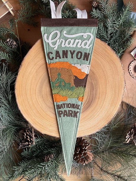
Grand Canyon (AZ) – South Rim focus
- Operations snapshot: Roads/trails open; many buildings/programs limited or closed. Expect sporadic restroom/trash service. North Rim largely closed (seasonal/fire impacts). Experience quality varies by day.
-
Side trips (bases: Tusayan • GC Village • Page):
- Desert View Drive overlooks 30–60m each (from GC Village/Tusayan)
- Horseshoe Bend ~2.5h • City-managed (Page)
- Antelope Canyon ~2.5h • Navajo Nation guided tours (Page)
Yosemite (CA)
- Operations snapshot: Park open; staffing thin. Valley access generally ok; Glacier Point/Tioga seasonal status applies. Expect minimal ranger presence, limited restrooms, and variable parking controls. Book lodging out of park for reliability.
-
Side trips (bases: Yosemite Valley/El Portal • Oakhurst • Lee Vining*):
- Valley viewpoints 5–25m • Wawona day hikes 45–70m
- Mariposa Grove 60–80m • Sierra NF trailheads 20–60m (from Oakhurst)
- Tuolumne pullouts 20–45m • Mono Basin 10–25m (from Lee Vining; *only if Tioga open)
Yellowstone & Grand Teton (WY/MT)
- Operations snapshot: Core roads typically open; some VCs may operate via partners, but plan for self-supported days. Facilities thin as shoulder season sets in; weather/road updates may be slower than normal.
-
Side trips (bases: West Yellowstone • Gardiner • Jackson • Cody):
- Mammoth–Gardiner corridor 10–30m • Big Sky/Gallatin NF 45–75m
- Moose–Wilson overlooks 15–35m • Bridger-Teton NF 15–60m (from Jackson)
- East Entrance overlooks 45–90m • Buffalo Bill Center (Cody)
Rocky Mountain (CO)
- Operations snapshot: Roads/trails mostly open; seasonal closures (e.g., Old Fall River) roll in. Services limited but manageable with town support. Good alternatives nearby if lots or restrooms are closed.
-
Side trips (bases: Estes Park • Grand Lake):
- Bear Lake corridor 15–40m • Roosevelt NF trailheads 5–45m (from Estes)
- Kawuneeche Valley turnouts 10–30m • State Forest SP 1–1.5h (from Grand Lake)
Glacier (MT)
- Operations snapshot: Shoulder-season but solid access; Going-to-the-Sun Rd recently open end-to-end (check day-of). Services limited; weather can change plans quickly.
-
Side trips (bases: West Glacier • St. Mary):
- Lake McDonald pullouts 5–25m • Apgar loops 5–15m (from West Glacier)
- Sunrift Gorge/Siyeh Bend 10–25m • Many Glacier 30–60m (road-dependent)
Joshua Tree (CA)
- Operations snapshot: Open-air access is fine; resource protection a concern under low staffing. Expect vault toilets at best, limited trash service, and variable campground status.
-
Side trips (bases: Joshua Tree • Yucca Valley • Twentynine Palms):
- Hidden Valley/Barker Dam 15–35m • Keys View 35–50m
- Cholla Cactus Garden 35–50m • Cottonwood area 50–70m (from Twentynine Palms)
Sequoia & Kings Canyon (CA)
- Operations snapshot: Giant sequoia groves and overlooks accessible when roads are open; facilities slim and seasonal closures common. Consider lodging out of park for predictability.
-
Side trips (bases: Three Rivers • Grant Grove • Visalia):
- General Grant/General Sherman areas 30–75m (road-dependent)
- Sierra NF trailheads 20–60m • Kaweah River corridor 10–40m (from Three Rivers)
San Francisco Bay Area – GGNRA & Muir Woods (CA)
- Operations snapshot: Muir Woods facilities closed (locked access). GGNRA open-air sites typically accessible; expect locked restrooms/parking in places. Presidio Trust areas fare better for services.
-
Side trips (bases: Mill Valley/Sausalito • SF/Presidio):
- Mt. Tamalpais SP trailheads 10–25m • Marin Headlands vistas 10–20m
- Presidio trails/overlooks 5–20m • Baker/Crissy Field (services vary)
Olympic (WA)
- Operations snapshot: Good shutdown profile: park access broad; some lodges/concessions (Lake Quinault/Lake Crescent/Sol Duc) typically remain open, offering food/fuel anchors. Restrooms variable.
-
Side trips (bases: Port Angeles • Forks • Quinault):
- Hurricane Ridge 20–35m (road-dependent) • Lake Crescent 30–50m (from Port Angeles)
- Rialto/Second Beach 20–40m • Hoh Rain Forest 60–90m (from Forks)
- Quinault Valley loops 10–40m • Nearby NF trailheads 15–60m (from Quinault)
Mount Rainier (WA)
- Operations snapshot: Paradise access often good; Sunrise area typically closes early October. Services limited; weather/road advisories can change quickly; expect minimal comms.
-
Side trips (bases: Ashford • Enumclaw/Greenwater):
- Nisqually–Paradise 45–70m • Longmire trails 30–45m (from Ashford)
- Sunrise viewpoints 60–90m • Chinook/White Pass corridors 60–120m (seasonal from Enumclaw/Greenwater)
North Cascades (WA)
- Operations snapshot: Open but services thin; SR-20/VC hours shift with shoulder season and weather. Plan for self-reliance and limited restrooms.
-
Side trips (bases: Marblemount • Winthrop/Mazama):
- Diablo Lake overlooks 30–60m • Gorge/Cascade passes (SR-20 status-dependent)
- Washington Pass overlooks 30–50m • Methow Valley USFS trails 10–45m
Great Smoky Mountains (TN/NC)
- Operations snapshot: Historically resilient to shutdowns due to partner support and abundant town services. Roads/trails widely open; amenities better nearby than in-park.
-
Side trips (bases: Gatlinburg • Townsend • Cherokee):
- Cades Cove Loop 30–50m • Little River Rd pullouts 15–40m
- Newfound Gap/Clingmans Dome 45–70m • Blue Ridge Pkwy access 10–25m (from Cherokee)
Acadia (ME)
- Operations snapshot: Open-air access ok; seasonal campground closures follow normal October timing; services minimal. Cadillac access may be curtailed; plan backups.
-
Side trips (bases: Bar Harbor • Winter Harbor/Schoodic):
- Park Loop Road pullouts 5–30m • Carriage Roads 10–25m (limited)
- Schoodic pullouts 5–20m • Ravens Nest 10–15m
Big Bend (TX)
- Operations snapshot: Roads/trails generally open; remote setting already favors self-supported travel. Expect limited amenities; town services are your anchor.
-
Side trips (bases: Terlingua • Marathon • Study Butte):
- Santa Elena Canyon 45–75m • Ross Maxwell Scenic Drive pullouts 20–60m
- Bofecillos/State sites & River Rd viewpoints 30–90m
Everglades (FL)
- Operations snapshot: Access depends on area; services and tours may be limited under low staffing. Mosquito/heat conditions vary—set expectations accordingly.
-
Side trips (bases: Homestead • Shark Valley • Chokoloskee/ECity):
- Shark Valley loop 10–30m (from US-41) • Big Cypress Oasis 20–45m
- Ten Thousand Islands boat launches (local operators) 10–30m (from Chokoloskee)
Shenandoah (VA)
- Operations snapshot: Skyline Drive access often good in fall; services pared back but plentiful towns along US-340/US-33/US-211 support visits. Foliage traffic can fill lots—arrive early.
-
Side trips (bases: Luray • Front Royal • Charlottesville):
- Skyline Drive overlooks 5–30m • Old Rag area (permit rules normally apply)
- Blue Ridge Parkway connectors 20–60m (from Afton/Charlottesville)
First, a Calm Game Plan
Visitor centers, restrooms, campgrounds, permits, and programs closed or curtailed. NPS websites/social feeds not reliably updated.
At some fee-funded parks, restrooms, trash, campgrounds, and entrance gates may continue temporarily.
State, tribal, city, and adjacent National Forest lands are unaffected and offer excellent substitutes.
“Before You Go” Checklist
- 🚻 Assume restrooms/trash closed (pack in, pack out).
- 🛣️ Expect locked gates/roads in some areas.
- 📵 Don’t rely on real-time NPS updates; use local radio/state pages.
- 🧾 Carry ATB pass + ID; fees may be collected where gates are staffed.
- 🧭 Verify day-of with state/tribal/forest sites for backups.
What We Know from Past Shutdowns
- 2013 (16 days): full closures, ~7.9M lost visits, ~$414M lost gateway spending.
- 2018–2019 (35 days): partial access led to trash/resource damage; later closures imposed.
- 2025 plan: ~2/3 of NPS staff furloughed; services only where funded by fees/donations.