


2027 Road Atlas & National Park Guide
2027 Road Atlas & National Park Guide is backordered and will ship as soon as it is back in stock.
 FREE Standard Shipping On Orders Over $100
Delivery in 2-5 Days
Delivery in 2-5 Days
We make every effort to ensure orders are fulfilled and ready for shipment within 2-3 business days. No orders are shipped on Saturday & Sunday.
Unless noted on a product's page, orders will ship in the order they were received. We will notify you via email as soon as your order is ready for shipment. Digital Products (Guides and Gift Cards) are available for immediate download or will be emailed to you.
Standard delivery times:
- U.S. orders: 2-5 business days.
- Orders to Canada: 5-9 business days.
- Other international orders: 10-15 business days.
FedEx Standard Overnight:
- Orders are delivered in 1 business day after fulfillment.
- Orders placed Monday - Friday after 12pm Eastern Time will likely ship the following business day.
Orders that are shipped and tracked with USPS: USPS does not make any guarantees on shipping times. Read our shipping policy for full details.
Supporting Small Businesses
Supporting Small Businesses
By purchasing any item from our store, you support local artisans and small businesses. We carefully select small businesses that share our love for the great outdoors. Your purchase makes a direct impact, helping these communities thrive.

2027 Road Atlas & National Park Guide is backordered and will ship as soon as it is back in stock.
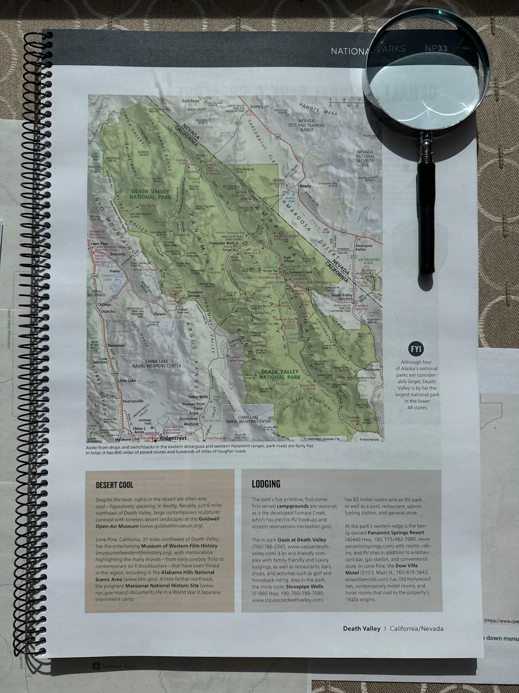
This all-in-one travel planning guide, designed and printed in the USA, is the only atlas highlighting the extraordinary beauty of every one of America’s 63 national parks while providing travelers with the trusted routing and points of interest tools they’ve relied on for generations. This new edition features a complete 2027 Rand McNally Road Atlas featuring the most up-to-date maps, more detailed city inset maps, and more travel planning information than the competitors, which is why it’s been the essential, trusted tool for road travelers for more than 120 years.
Why Choose Rand McNally Over the Competition?
-
Complete National Park Coverage
Includes all 63 U.S. national parks in one authoritative atlas. -
Unmatched Park Detail
132 pages dedicated exclusively to national parks. -
More Pages per National Park
2–4 full-color pages per park for deeper exploration and trip planning. -
QR Codes for Every National Park and State Maps
Provides regular updates for events, celebrations, and points of interest you won't want to miss on your journey. -
National Parks by Decade
A unique 6-page feature tracing the history of America's national parks. -
Unmatched Park Detail
132 pages dedicated exclusively to national parks. -
Vivid, Inspiring Photography
379 full-color photos that bring each park to life. -
Bigger, More Comprehensive Atlas
280 total pages. -
Expertly Crafted Maps
Created by our USA based, in-house cartographic team, not by 3rd parties used by our competition. -
Always Up-to-Date
Updated annually for accuracy and reliability. -
Larger, More Readable Maps
Larger maps for easier navigation and planning. -
More City Inset Maps
378 detailed city inset maps. -
Easier on the Eyes
Clean white backgrounds and vibrant, user-friendly color palette. -
Updated, Accurate Location Names
Reflects the latest naming standards from the U.S. Board on Geographic Names and the Department of the Interior. -
Tough Spiral Binding and UV Coated Cover
Spiral binding allows pages to lay flat, and UV coating adds durability. -
Made in the USA
Designed and printed in the United States.
Product Details:
- Paperback
- Spiral bound
- 280 pages
- Dimensions: 11" x 15